The Rapson Bay gold property is 100% owned and operated by Northern Superior Resources Inc. This property was staked to cover the confluence of two fertile structures associated with the Stull-Wunnimun fault and the Wolf Bay shear zone, which display similar structural characteristics and potential mineralization as the Destor-Porcupine or Cadillac-Larder faults. Drilling programs on the Rapson Bay property during the fall of 2011 lead to the discovery of a gold-bearing porphyry system in the Shoal Lake area and a gold-bearing shear system in the Wynne Bay area.
The Rapson Bay property (100% NSR) is located in northwestern Ontario within the fertile Stull Lake Greenstone Belt (SLGB) of the Red Lake mining district. The property currently consists of 113 mining claims (26,768 hectares) and is located approximately 60 km north of the Community of Sachigo Lake First Nation with whom the Company has signed a Letter of Agreement supporting the exploration program.
2011
Exploration Highlights
SHOAL LAKE
On January 11, 2012, Northern announced that it intersected a mineralized porphyry system in the “Rapson Bay Shoal” area.
Mineralization was intersected in drill hole WB-11-008C, consisting of three mineralized zones. The main zone assayed 1.83 g/t gold, 6.65 g/t silver, 1.08%copper, 0.059% molybdenum over 18.0 m. There are two adjoining peripheral zones, Peripheral Zone 1 assayed 0.27 g/t gold, 0.67 g/t silver, 0.22% copper and 0.009% molybdenumover 19.6m; Peripheral Zone 2 assayed 0.37 g/t gold, 1.92 g/t silver, 0.32% copper and 0.017%molybdenumover 14.9m (note this last width is a minimum value and additional sampling of core is required). The entire mineralized zone assayed 0.83 g/t gold; 3.07 g/t silver; 0.55% copper; 0.028% molybdenum over 52.5 m.
It is important to note that porphyry deposits are considered the world’s most important source of copper and molybdenum and a key source of gold and silver. Most consist of copper values that range from 0.2 to more than 1%, molybdenum values that range from 0.005 to 0.03%, gold values that range from 0.004 to 0.35 g/t and silver values that range from 0.2 to 5 g/t.
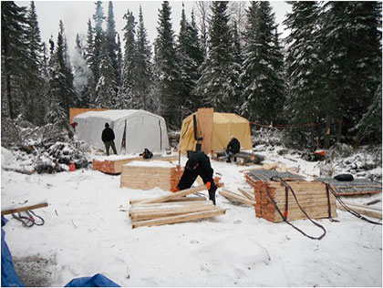
Drill core processing facility. Core is transferred from the drill site to this facility where it is logged, sampled and packaged for shipment to a laboratory for assay work.
WYNNE BAY
On January 23, 2012, the Company announced that it had defined a potential 4 km fertile section of the Stull-Wunnimun fault in the Wynne Bay area of its 100% owned Rapson Bay gold property. All seven early exploration drill holes (1,850 m) contained intersections that returned positive assays for gold above background levels of 100 ppb, including an intersection of 32.6 g/t gold over 1.0 m from hole WB-011-05C. A total of 32 different mineralized zones were intersected within a variety of volcanic and metasediments with lengths ranging from 0.5–9.0 m clearly indicating the fertile nature of this target area.
This area of interest occurs within a splay of a southwest fault associated with the highly prospective Stull-Wunnimun fault. This fault extends west-northwest from the Wynne Bay area to the Monument Bay gold deposit, 28 kilometres to the west-northwest of Wynne Bay. The Wynne Bay area has a history of gold exploration where multiple gold showings have been previously reported, including a historic outcrop sample of 1.65 ounces per ton. It is important to note that a northwest trending Wolf Bay shear zone also extends across the property to the Little Stull Lake gold deposit.
2011
Exploration Highlights
a) Signed an exploration agreement with Sachigo Lake First Nation;
b) Expanded the property from 15 claims (3,840 hectares) to 111 claims (26,135 hectares);
c) Completed prospecting, mapping and overburden sampling programs;
d) Completed an airborne, total magnetic field survey consisting of 5,124 line kilometres;
e) Completed two, ground-based, induced polarization and magnetometric geophysical surveys, for a total of 28.6 line kilometres; and
f) Completed a 9 hole, 2,549 m diamond drill program that lead to the discovery of:
i) A new sheared gold-porphyry system, the main zone assayed 1.83 g/t gold, 6.65 g/t silver, 1.08% copper, 0.059% molybdenum over 18.0 m, including the peripheral zones 0.83 g/t gold, 3.07 g/t silver, 0.55% copper and 0.028% molybdenum over 52.5 m (see press release January 11, 2012); and
ii) Defined 4 km long gold-fertile section of the Stull-Wunnimun fault highlighted by an intersection that assayed 32.6 g/t gold over 1.0 m (Note: all seven holes returned positive assay values for gold above background values of greater than 100 ppb, thirty-two different mineralized zones were intersected – see press release January 23, 2012).
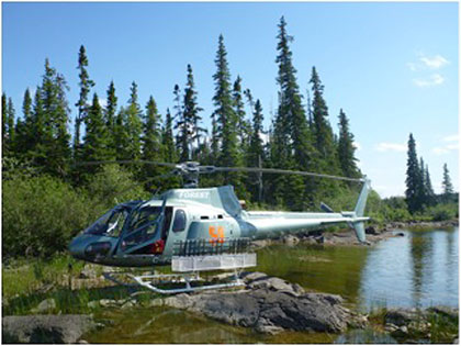
Helicopters and float planes are key means of transportation to access the Rapson Bay property.
2012 OUTLOOK
a) Retrieve core from site for further analysis; and
b) Assess all data from the 2011 exploration programs to identify targets for a diamond drill program.